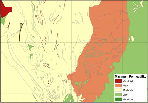
 EDINA has added two new datasets to Geology Digimap ahead of the planned release date because of their usefulness when researching floods.
The new datasets have been provided by the British Geological Survey along with several other major products. The Geological Indicators of Flooding and Permeability Indices have been made available from the Geology Download facility early due to the recent flooding events across the UK.
 These datasets along with LandCover data from Environment Digimap and digital terrain models, such as OS Terrain 50, from Digimap Ordnance Survey Collection, are all important pieces of information when researching flood risk, causes and potential methods of mitigating against them.
More information about these datasets can be found in the Geology Digimap help pages:
In addition to the two datasets already mentioned there are more new BGS products on the way. You can already download the Superficial Deposits Depth Model and we have the Soil Parent Material data coming soon.
Finally we hope to be integrating the most detailed geological mapping data at 1:10,000 and 1:25,000 scales to both Geology Roam and Geology Download.
If you require any assistance with these datasets or combining them with existing data from Digimap then please let us know:
- Email: edina@ed.ac.uk
- Tel: 0131 650 3302
