Any views expressed within media held on this service are those of the contributors, should not be taken as approved or endorsed by the University, and do not necessarily reflect the views of the University in respect of any particular issue.

Re-thinking Cultural Heritage and Climate Change Adaptation

A free course exploring cultural heritage as a lens to critically question conventional approaches on adaptation

Sri Lankan Food

3.3 Sri Lanka: Environmental folklore and traditional climate knowledge systems

The power of environmental folklore and cultural memory for understanding climate change risk and adaptation

Climate change impact on cultural heritage is one of the obscured areas in Sri Lankan academic scholarship. The prevailing knowledge gap creates an urgent need to reconstruct the indigenous and local climate knowledge systems in Sri Lanka, constructed through a comparative study. The case studies were selected representing ethnic and cultural diversity and cross-regional basis to support this comparative study. This research examines the traditional knowledge systems as a comparative study. Environmental folklore (Intangible Heritage) was collected from small-scale tank cascade village cultures in Sri Lanka.

This conventionally neglected research elaborately magnify the local ecological knowledge, traditional livelihood, contemporary social norms and dynamics, and harmonious connection between culture and nature.

One of the advantages of collecting data from folklore is the opportunity to obtain a detailed version of the profile of women in respective village cultures. Cultural memories of the peoples who are the stakeholders of the Sri Lankan hydraulic civilization offer a detailed narration that is robust enough to fill the lacunae of the social life of women non-elites sidelined in heritage studies.

The research focus

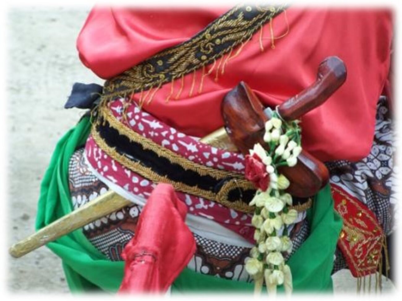
This research mainly examines the role of women in small-scale tank cascade village communities in Sri Lanka as a response to extreme weather events and climate change. Main case studies focused on locations Galtemwewa, North-western province, Moragoda, North-central province, Kalukele, and North-central province. The sub-case studies were conducted to compare the role of women in different ethnic and cultural settings. These locations are Sri Lankan aboriginal community in Dambana, Uva province, Tamil Island community in Delft Island, Northern Province, and coastal fishing community, Ulhitiyawa, North-western Province. Status of women, gender attribution, gender identities, gender roles of these societies were identifies and compared.

Whose heritage?

The earliest writings about Sri Lanka’s history were mainly based on colonial constructions. The main streams of their approaches were colonialism, orientalism, imperialism, and antiquarianism. According to the content of this literature, it is clear that the colonial writers had a preconceived notion about Sri Lankan culture in attempts to understand Sri Lankan life, behavioral patterns, beliefs, rituals and flora, and fauna.

A great number of volumes written the Sri Lankan irrigation systems and detailed recordings of Ceylon ecology and traditional livelihood were used as a tool of colonialism and this understanding helped the colonial administration to plant the Eurocentric values on Sri Lankan earth. This situation created an inferiority complex over traditional livelihood in traditional village cultures, and they started giving up their traditional indigenous values and knowledge systems. However, the knowledge they record can be used as a valuable archival collection.

There is a growing body of literature about tank cascade systems, ecology, biodiversity, agrobiodiversity, biophysical changes, climate change, groundwater chemistry, food and water security, dramatic changes in village cultures and traditions sustainability (Maddumabandara, Marambe, Darmasena, Gunasinghe ) These researches examine the Sri Lankan tanks and agricultural societies through environmental and sociological aspects. They draw our attention to the wider environmental aspect including climate change and environmental relations and issues beyond ancient ingenuity and water management. These research helps to understand the human intervention to the natural environment and their environmental sensitivity and ecological knowledge.

The characteristic elite bias of existing literature and the grandeur of the ancient built environment sidelined the small-scale tank cascades in village contexts.

Traditional livelihood, climate risks, their adaptation strategies were not adequately examined in the Sri Lankan historiography and heritage studies scholarship. The invisibilization of women in these agrarian societies is a knowledge gap of existing literature.

There is a growing body of literature on water security, agriculture, and climate change in Sri Lanka. The gender lenses to climate change and exploring this area through folklore (intangible heritage) and cultural practices and memories were done for the first time of its kind through this study. So, this research undoubtedly fills the gaps in an obscured area in climate science and cultural heritage studies.

Climate Profiles

Temperatures have increased across Sri Lanka, especially since 1980, although these trends are less significant than other parts of the globe. The South Asian monsoon has weakened, causing a decrease in precipitation in the second half of the 20th century, as a result of anthropogenic aerosol forcing (IPCC 6th assessment report). There is variation in rainfall across Sri Lanka, with the southwest experiencing much greater rainfall than the northwest and southwest.

Temperatures across Sri Lanka and the surrounding ocean areas are expected to increase over the next century. Heatwaves and humid heat stress will also be more frequent and intense (IPCC 6th assessment report).

Gender and Environmental Knowledge

Women are often identified as the most vulnerable and victims of extreme weather events. However, this study found challenges faced by women such as gendered division of labour and gender tasks can also enrich and strengthen them with the knowledge of local ecology, traditional weather forecasting, and household management, proactive in water related conditions.

This research offers an alternative profile of energetic and empowered women, providing an alternative picture beyond the domestic sphere demonstrates the strength, capacity, skills, and responsible consumerism and futuristic approaches of women towards the well-being of the family, the society and environment.

Role of women as a heritage bearer and her indigenous climate knowledge can effectively contribute towards climate solutions, climate change adaptation strategies and environmental decision making.

Intergenerational knowledge

Local people explore and examine the natural environment thoroughly and work in alignment with nature. The behaviour of animals, trees, clouds, rainfalls, and many more facets of nature tell them about the natural climate cycle. Moreover, they have ecological memories of the climate hazards.

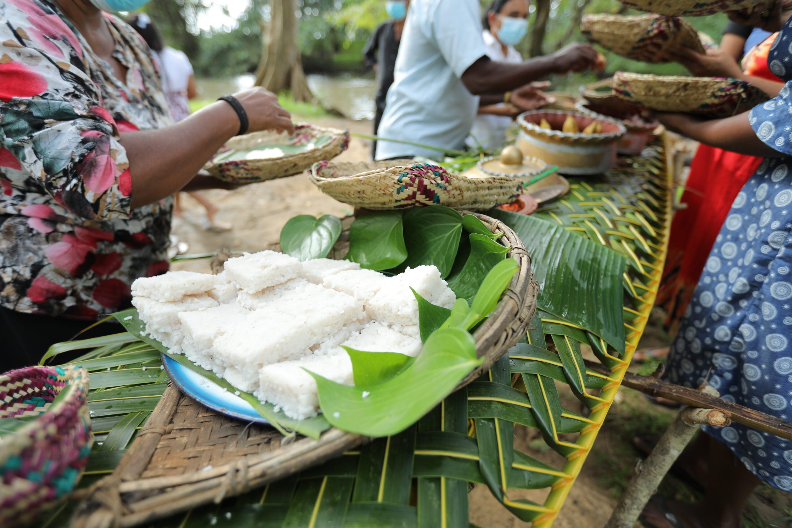
The villagers have embedded these climate literacies into the indigenous knowledge and passed them down to the next generation to identify the climate change in advance. The folk songs were the best method that worked for this. The children could easily memorize by heart these factors as they were sung by their elders constantly.

For example, tree worship is considered a divine attribution to nature to nurture and save their catchments. Social organization is functioned by customary laws and people understand the importance of the environment and how it badly impact human if they damage to nature. On one hand, they put moral obligations to maintain responsible consumerism and explained the aftermaths of over consumerism. They embedded these ideas in the advisory folksongs and all work songs.

People are told that the trees were the divine home of gods and goddesses. As a result, deforestation was highly discouraged. People started some small shrines next to the trees and hang a branch of the tree whenever they pass the tree. This is a living tradition in the tank cascade villages. These divine attributions are superstitions but they work very well in the village setting in terms of environmental protection and more effective than government laws and rules.

A changing world

Sadly, although this research identified many traditional mechanisms for water and land management that have been passed down through generations, the research also identified some emerging risks faced by the communities. These include:

  • Unidentified kidney disease – likely due to the chemical fertilizers and pesticides, heavy metals, and chemicals.
  • Vector-borne disease – Malaria, Dengue
  • Covid 19 has impact the elderly community and therefore there is a loss of traditional skills and knowledge at a rapid rate.
  • All these three above health issues caused the death of the elderly community and farmers who were recognized as heritage custodians.
  • Younger generations tend to seek new occupations and give up their traditional agriculture and craft activities.
  • Industrial agriculture and traditional paddy cultivation tools are replaced with modern machines. So, work songs are not sung anymore in many villages, and womens’ labour such as reaping, threshing, gathering, and winnowing is done by machines. Community-based agriculture is slowly disappearing. The machines require fuel and cause carbon emissions can be recognized as environmental issues.
  • There is a vacuum in the traditional knowledge and interpreting the knowledge

Click here to explore more about Cultural memory for resilience in Sri Lanka.

This is one of the ArcGIS story map series from the CRITICAL project. Dr Kate Crowley set up the story map from the Sri Lanka case study provided by Dr Dulma Karunarathna.

About the research

This e-learning course has emerged from a research project funded by the Arts and Humanities Research Council and the UK Government Department for Digital, Culture, Media and Sport’s (DCMS) exploring climate change adaptation and cultural heritage.

What’s the project called?

CRITICAL: Cultural Heritage Risk and Impact Tools for Integrated and Collaborative Learning

Watch this short video to learn more about the CRITICAL project.

Who is part of the team?

Our team includes researchers in Sri Lanka, South Africa, Scotland and Indonesia!

The team at the University of Edinburgh, UK, includes Dr Kate Donovan, Dr Rowan Jackson and Dr Younghwa Cha.

In South Africa, research examining food heritage and vulnerability is being led by Prof Siona O’Connell and Ms Dominque Wnuczek-Lobaczewski from the University of Pretoria.

In Sri Lanka, Dr Dulma Karunarathna is working on traditional climate change adaptation.

In Indonesia Dr Arry Retnowati and Ms Esti Anantasari from the Universitas Gadja Mada are examining cultural landscapes and natural hazards.

We represent communities from all over the world and hope to share our understanding of the relationship between cultural heritage, disasters and climate change.

Why is it important to understand risk?

There is an urgent need to support the world’s most vulnerable populations to adapt and thrive to rapid environmental change. Understanding climate change and disaster risk is the fundamental first step towards building resilience. This involves understanding both the hazard but also the people and assets exposed to that hazard.

Why should we care about cultural heritage and risk?

Cultural Heritage shapes our identity, delivers capacities and exposes vulnerabilities yet cultural value and vulnerability are missing from conventional risk assessments that support sustainable development and growth. Fundamentally, this means that the things that motivate people, build their resilience and in some cases make them susceptible to hazards is missing from decisions about adaptation and emergency management.

Understanding the vulnerability and value of cultural heritage (e.g. beliefs, buildings, and traditions) is vital to building resilience globally.

What are we doing?

We are working in partnership across Indonesia, South Africa, and Sri Lanka to combine heritage management, cultural geography and climate risk research to form a community of practice focused on Low and Middle Income Countries (LMICs). Our diverse team aim to identify and develop interdisciplinary methods to capture the ‘invisible’ vulnerability and value of heritage and incorporate this within risk assessment.

Crucially, this project will collate and share diverse experiences, knowledge and skills to build a portfolio of pilot case studies from the three LMICs on cultural value for climate and disaster risk assessment and management.

The project will finish in early summer 2022 but we will update the course as new learning emerges.

How will I learn and how long will it take?

Course introduction

What are the course contents?

This course consists of short videos, text and reflective commentaries.

The videos provide inspiration on various topics whilst the text provides deeper insight.

The reflective commentaries help you to reflect on, and interact with, the topics. Watch this first video to learn more.

How long will this take?

Each module is designed to take between 1-2 hours per week. We therefore hope that you can work through the materials in 4 weeks or less.

Each module also includes optional additional reading materials provided.

There is no assessment and this course is not accredited.

Meet the Team

This course was developed by the CRITICAL research team.

Full team and affiliations:

Kate Crowley1; Rowan Jackson1; Siona O’Connell2; Dulma Karunarthna3; Esti Anantasari4; Arry Retnowati4; Dominique Niemand2 , Younghwa Cha1, Ashrika Sharma1, and Aythya Young1.

  1. School of GeoSciences, University of Edinburgh, Edinburgh, UK
  2. Faculty of Humanities, University of Pretoria, Pretoria, South Africa
  3. Centre for Asia Pacific Initiatives, University of Victoria, Victoria, BC, Canada
  4. Centre of Excellence in Technological Innovation for Disaster Mitigation (GAMA-InaTEK), Universitas Gadjah Mada, Yogyakarta, Indonesia

CRITICAL aims to work in partnership this project will combine heritage management, cultural geography and climate risk research to form a community of practice including researchers from South Africa, Sri Lanka and Indonesia to:

1) identify the key parameters for cultural heritage impact assessment;

2) deliver risk scenarios for decision-making, and

3) share resulting tools and learning through a capacity building and research-to-policy strategy.

We have a blog site to explore as well: Climate Change Adaptation and Cultural Heritage – A space for sharing stories, ideas and updates from research and learning on climate change adaptation (ed.ac.uk)

3.4 Indonesia: The heritage landscapes of Yogyakarta city

The changing nature of heritage landscapes and disaster management in Yogyakarta City in Central Java

The study sought to understand the correlation between climate-related hazards and the cultural heritage which connects people or the community to their environment. Early on it was apparent that the river systems that cut through the city of Yogyakarta from their source on Mt Merapi to their mouth at the south sea are critical heritage assets.

The River Code became a focal point for the study. Interviews, desk study, and field observation were conducted to better understand and identify the heritage of Yogyakarta city and the natural landscape of the province stretching from the Merapi volcanic area southward along the main southern rivers to the sea – a traditional Javanese cosmological axis through the city.

This study coincided with an application to UNESCO to create a city wide World Heritage Site in Yogyakarta. But the research team were concerned that  the proposal put to UNESCO in early 2021 includes no climatic factors discussed, and the designated area of the cosmological axis proposed to UNESCO has not included the river or water issues in the discussion and the proposal.  The designated area mainly focuses on the historical building with economical values at present.

This research thus explored on how to build a resilient community that relates to its heritage value, also on how far policy making (regulations) consider local level community heritage values.

A cultural centre

The Special Region of Yogyakarta is located in the southern part of the island of Java, directly adjacent to the Indian Ocean. Yogyakarta is one of the well-known destination cities for tourism and education in Indonesia. Yogyakarta is a city and also a provincial area. As a province, it is known as Yogyakarta’s “special” province or Daerah Istimewa Yogyakarta due to its significance in Javanese history and national identity. The morphological layout of Yogyakarta has a cultural concept called Hamemayu (Memayu) Hayuning Bawono, which means to manage the earth (environment) wisely to maintain sustainability.

Given its geographic location the city is prone to earthquakes, volcanic eruptions, landslides, floods and droughts. Hazards and their risks have been historically taken into account and shared by the people of Yogyakarta in their daily life based on experiences, stories, and written knowledge. The knowledge has evolved and developed into the concept of the symbiotic character of humans responding and reacting to nature.

Catastrophic changes in the natural physical environment resulting from climate change, such as flooding, rising sea level, and its associated coastal impacts, and landslides can have great impacts on cultural heritage, both tangible and intangible. Yogyakarta, as one province in Indonesia, faces several hazards due to its physical features and anthropogenic factors. Changing climate trends and weather hazards are gradually impacting rural areas on the outskirts of Yogyakarta and within the city of Yogyakarta. Agriculture and ecosystem-based tourism sectors annually experience hydrometeorological hazards with potential risk and disaster. In the urban area, the climatic factors disrupt daily urban activities, particularly for the tourism sector dependent on visitors to monuments, landmarks, and the cultural landscape of the City of Yogyakarta.

Vulnerability for cultural heritage needs to take into account the aspects of the heritage itself, both intangible and tangible.

Climate Profiles

A long term warming trend across Asia has accelerated since 1970 and drought and floods are of major concern across every region in Asia (IPCC- AR6). Heat waves are becoming more frequent, longer- lasting and more intense across most of Southeast Asia (Li, 2020).

Average monthly rainfall in Java fluctuates similar to the Australian monsoon pattern throughout the year, with highest rainfall occurring in December and January (350 mm/month) and the lowest in August (80 mm/month). Precipitation related hazards, such as drought and floods are of major concern across every region in Asia (IPCC AR6). Average monthly rainfall in Java fluctuates similar to the Australian monsoon pattern throughout the year, with highest rainfall occurring in December and January (350 mm/month), and the lowest in August (80 mm/month) and low between June and September. Precipitation is higher in the southwest and central Java. Annual rainfall in Yogyakarta is relatively high compared to the rest of Java, and appears to be increasing in more recent years (Faradiba., 2021). 

Changes in precipitation are often a result of weather patterns such as the El-Niño and La-Niña (Berliana et al., 2021). The arrival of an El-Niño such as in 1997 and 2015, resulted in a prolonged dry season, whilst La-Niña, such as in 1999/2010 and 2016, causes an increase in rainfall and sea level surges which caused flooding across Indonesia, especially along the coast (Handoko et al., 2021). Drought and flooding affected a reduction in crop production, as well as the potential to significantly alter groundwater and drinking supplies (Hohl et al., 2020 and Susanti et al., 2021). Future projections note that although precipitation may decrease leading to drought and water shortage, monsoonal rains and extreme rainfall associated with tropical cyclones may increase. These extreme rainfall events could lead to flooding and remobilization of volcanic material (lahars) within the Yogyakarta river systems.

The coastal areas of Yogyakarta are at risk of sea-level rise such as the Galur district being abraded by more than 350 square metres, whilst Srandakan grew by 270 square metres between 2000 and 2018 (Susanti et al., 2021).

Future sea level change is likely to continue and exceed current rates in the oceans around Asia ranging from 0.3-0.5m under SSP1-RCP2.6, to 0.7-0.8m under SSp5-RCP8.5 for 2081 to 2100 relative to 1995-2014 (IPCC AR6). Sea temperatures and coastal floods are also estimated to increase (IPCC AR6).

The heritage landscape of Yogyakarta

The city is connected to the volcano Mt Merapi, in the north and the Indian Ocean in the south via a series of river systems. This is know as the cosmological axis of Yogyakarta and it links a series of tangible and intangible heritage assets including the volcano together with the Sultan’s Palace, and the Parangtritis coastal area.  Along this route are many heritage sites of signifcant national value including Prambanan Temple (a World Heritage Site), Malioboro Street, Tuga Monument, and Kotagede.

The Indonesian Charter for Heritage Conservation (2003) stated that 1) The heritage of Indonesia is the legacy of nature, culture, and saujana (landscape and livescape); 2) Cultural heritage includes both tangible and intangible legacies; 3) Heritage, bequeathed from the generations that precede us, is a vital foundation and initial capital for the development of the Indonesian nation in the future, and for these reasons, must be conserved and passed along to the next generation in good condition, without loss of value, and if possible with an enhanced value, to form heritage for the future.

There is a strong interconnectivity between the community and the cosmological axis. The rivers shape the whole landscape as part of the axis that connects Merapi volcano, the Sultanate Palace, and the Parangtiris coast. These locations symbolize human and the spiritual aspect (God) connections. This philosophical heritage is repeatedly introduced to visitors spending their time in Yogyakarta.

There are gaps in understanding the influence of climate change and current political decisions on heritage management.

In this area the value of the River Code varies considerably from national to local government and their drive to propose the cosmological axis as one World Heritage Site, and the local people who live and interact with the river and it’s hazards. This research therefore aimed to explore the river as heritage, and understand the local and regional narratives associated with heritage and natural hazards.

The river as a tool for connecting people and their heritage

With a backdrop of dynamic environmental conditions in Yogyakarta, there are  historical landmarks that were placed alongside several geographical icons such as mountains, rivers, and oceans. Those icons do not stand alone, but they are parts of a constellation of cultural sites and the cultural values have been continued to bind, live, and interpreted in various ways by the people of Yogyakarta.

For example, indigenous knowledge and cultural memories relating to Merapi volcano, such as beliefs, livelihoods, and the kinship of the people who live around volcano will always be there, even if one day the tangible heritage disappears. This indicates that Yogyakarta has cultural value through the intangible heritage which is constructed around the landscape and provides  guidance to the way people protect and interact with their environment.

The River Code’s inhabitants, for example, held regular and annual events or ceremonies to build public awareness in the conservation of the Code River existence as part of valuing cultural ecosystem services. Merti Code is one of the traditional knowledge areas regarded as ecosystem service based on human and environmental connections. Merti is a Javanese word that means “taking care of something”. The Winongo river inhabitants held the merti river, similar to the Code River community. Such behaviour, knowledge, and daily practices have shaped the cultural landscape of Yogyakarta.

Traditional warning systems are being lost. For example, environmental folklore relating to lahar warnings are now not being passed through generations because of the changing communities alongside the river.

Dynamic change

Cultural heritage in this region is always changing, it reacts to changes in the landscape through floods, volcanic eruptions and earthquakes and to globalisation. Since, the 1970s the river banks have become slum areas, with new immigrants seeking cheap lands to populate. The Code River banks have become densely populated and this has caused a sever decline in water quality. What was once a source of drinking water and regarded as healing waters are now polluted. The city itself has also taken advantage of the river systems, with an increase in tourist facilities such as hotels, hostels, restaurants, souvenir shops, markets, offices.

In some areas there is hope, with local residents forming their own community groups to protect the river, share their knowledge but also ensure local people can take advantage of relevant tourism.

Here heritage provides a significant source of livelihood in the city and yet some ancient heritage is threaten by pollution, loss of traditional knowledge that focuses on the protection of the environment and how to live alongside nature. The UNESCO World Heritage Site status for the city provides economic benefits but questions remain about how will this benefit those living in the city? Are we seeing yet another shift away from local value of heritage to something ‘global’ and sanitised? And how can we protect these sites if natural hazards are not considered within the planning of cultural urban spaces?

Final recommendations

  1. Climatic factors should be included into heritage management and development planning.
  2. Re-introduce climatic factors to all stakeholders and the communities alongside the cosmological or philosophical axis of Yogyakarta to create a mitigation and adaptation awareness culture.
  3. Strengthen the role of the community and cultural value with environmental preservation, and as the main driver in the management and development of the Code River.
  4. Implement Nature Base Solutions t to protect the philosophical values of the Yogyakarta axis

Click here to explore more about Kali Code: Heritage landscapes in Indonesia

This is one of the ArcGIS story map series from the CRITICAL project. Dr Kate Crowley set up the story map from the Indonesia case study provided by Dr Arry Retnowati, Esti Anantasari and Indriya Parahita.

Page 2 of 2

Powered by WordPress & Theme by Anders Norén

css.php

Report this page

To report inappropriate content on this page, please use the form below. Upon receiving your report, we will be in touch as per the Take Down Policy of the service.

Please note that personal data collected through this form is used and stored for the purposes of processing this report and communication with you.

If you are unable to report a concern about content via this form please contact the Service Owner.

Please enter an email address you wish to be contacted on. Please describe the unacceptable content in sufficient detail to allow us to locate it, and why you consider it to be unacceptable.
By submitting this report, you accept that it is accurate and that fraudulent or nuisance complaints may result in action by the University.

  Cancel