Ongoing Research Projects
Foreland Basin Dynamics
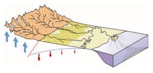
 Foreland basins represent the downward flexure of the continental lithosphere induced mainly by the topographic load of a mountain range. These basins trap much of the sediment that is sourced from the mountain range, and so contain a stratigraphic record of the long-term processes of mountain building. In the shorter term, foreland basins act as an important buffer between the tectonic and climatic events in mountains that determine sediment yield such as earthquakes, landslides and storms, and the densely populated deltaic regions of the world. An important example of this is the Himalayan mountain chain that delivers sediment to the Indus and Brahmaputra rivers. It has been estimated that the foreland basin represented by the Ganga Plains traps about 10% of the sediment yield of the Himalaya, and that it takes a few tens of thousands of years to transit signals of changing sediment yield from the mountains to the deltas.
My work in this field, in collaboration with many international colleagues has resulted in a range of publications that started during my PhD working on the Alps (e.g. Sinclair et al., 1991) that then led to the model for underfilled foreland basins (Sinclair, 1997) and then more recently looking at the generic aspects of basin dynamics in the context of pro- versus retro-thrust wedge settings from across the globe (e.g. Naylor & Sinclair, 2008; Sinclair and Naylor, 2012). More recently, I have focused on the Himalaya/Ganga Plains system as it supports nearly 10% of the global population, and so understanding the dynamics of sediment delivery and basin subsidence underpins understanding of long-term flood risk in the region (e.g. Dingle et al., 2016; 2017).
‘Sounding out the River’ – Monitoring the River Feshie

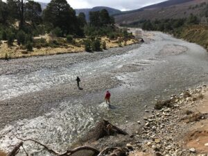
The aims of the project are to use an array of seismometers linked to river gauges, cameras, and hydrophones in order to determine the river discharge responsible for the mobilisation of coarse sediment bedload in the River Feshie in the Cairngorms of Scotland. Much of this work has been technical in terms of developing remote monitoring techniques and determining the characteristics of environmental noise versus the signal of the movement of pebbles on the river bed. This is important as sediment mobility impacts downstream flood risk and delivers coarse sediment to the River Spey. Our future plans are to apply these techniques to reducing flood risk in the Gangetic Plains of Nepal and India (see PhD proposal below).
This project is led by my colleague Mark Naylor who has written an extensive blog about the project. The project has been funded by a NERC grant and a PhD student, Bronwyn Matthews.
We are currently advertising a PhD project building on this theme.
‘Tomorrow’s Cities’ – Flood risk in Kathmandu

Tomorrow’s Cities is the UK Research and Innovation (UKRI) Global Challenges Research Fund (GCRF) Urban Disaster Risk Hub – a five-year global interdisciplinary research hub. The overarching aims of the project is to catalyse a transition from crisis management to multi-hazard risk-informed planning and decision-making, for four cities in low-and-middle income countries; Quito, Istanbul, Nairobi and Kathmandu.
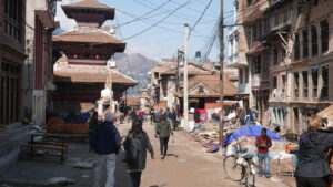
My input into this large project is as the UK lead for the Kathmandu team, and coordination of the assessment of flood risk for Kathmandu through statistical and modelling approaches. Our flood team are part of the Land Surface Dynamics research group in Edinburgh and are collaborating with the University of Glasgow, Tribhuvan University in Kathmandu and the NGOs Practical Action, SIAS and NSET. For an overview of our activities in Kathmandu see: https://tomorrowscities.org/city/kathmandu
Impact of sediment mobility on flood models
 Most predictions of flood inundation solely require a hydraulic model of water flowing over a digitised topography with varying roughness characteristics. However, in many parts of the world, particularly where rivers emerge from mountain ranges, the role of sediment transport during floods is critical in modifying flood distributions and intensities.
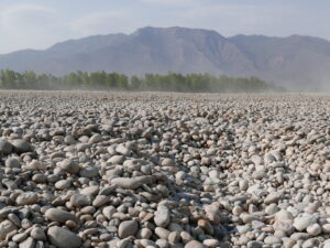
Our work on the Karnali River in western Nepal has shown the sensitivity of flood inundation to changes in channel geometries due to sediment accumulation (Dingle et al., 2020). A current PhD student, Saraswati Thapa, is using a version of the Caesar Lisflood flood modelling software to explore the impact of varying grainsize distributions and sediment flux on flood predictions in the Kathmandu Valley linked to the Tomorrow’s Cities project. This work will explore the role of changing landslide flux and sand mining on flood risk to the newly developed suburbs of Kathmandu. Engagement with relevant stakeholders has been facilitated through our partnership with Practical Action Nepal.
more to come on….
The role of sediment grainsize in rivers
The Origin of the Kathmandu Basin


Comments are closed
Comments to this thread have been closed by the post author or by an administrator.