MAKING AND BREAKING NARRATIVE #1
research focussed
cartography. where science meets art. where power is represented visually. where misunderstandings begin. and where the cartographer makes the rules.
outlining history and problematics
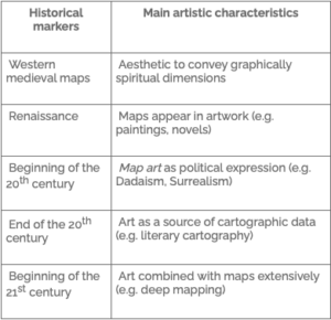
ancient greece: were extensively influenced by scientific procedures based on geometry and astronomy.
western medieval: maps utilized artistic techniques and aesthetic approaches to communicate religious and mythical beliefs about the world.
renaissance: maps played a key role in exploration and colonization, helping navigators to access and claim territories around the world. this period is also distinguished by the rediscovery of antique scientific practices, improved by new tools and techniques of mapmaking.
western modern maps: were born within that context where the nation states and the formal sciences in academies were being established. aligned with the emergence of modern states in europe and their expansion via maritime explorations, cartography left ancient symbolism in favor of a more functional vision
(http://gistbok.ucgis.org/bok-topics/cartography-and-art)
RESOURCES
-
- Legende V, 1999, Pia Arke
-
- Wood, Unknown
-
- Map series, 2014, Mia Mendes
-
- Map series, performance, 2014, Mia Mendez
-
- Fault lines, 2003, Doug Beube
asking oneself
finding online that most cartography history is focussed on the western mapmaking. questioning where the ‘others’ maps are? the maps made by greenlandic inuits cut in wood long before the colonisation etc. questioning how western power is represented in cartography throughout time. questioning the male dominions in western power and the lacking representation of that exact.
process
making and breaking the narratives that exists within the practise of cartography though representation of imaginary maps, maps made from assumptions or maps that represent social structures. what is a map in reality and how does it work when taking the methods of mapmaking or reflecting upon the history of the practise and reconsider what a map should do or what a map is supposed to do. where does the boundaries go between art and science when dealing with maps?
project
making a work that challenges the way we understand a map today and throughout the history. changing the geographical sizes of countries, borders and the tendencies that exists within. expressing how changes within the world affects us, how the history changes the way we understand the world around us and the tendencies expressed through cartography, challenging how a map can be both the truth and a subjective or colonial representation of land, landscape and hierarchy.
MAKING AND BREAKING NARRATIVES #2
presenting a work
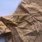
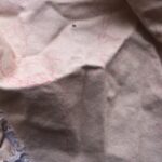
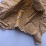
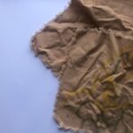

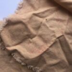
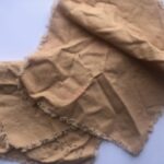
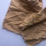
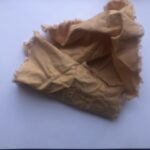
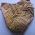
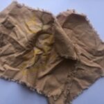
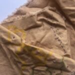
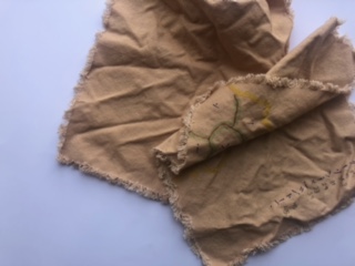
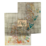
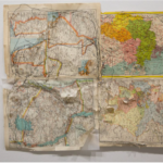
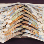
this work, presented in pictures bring together some of the tematics discussed above. the history of maps and mapmaking is represented in material value – a stereotypical idea of a ‘old’ map. there is two maps in this work. one of which shows the european countries, sizing based on the percentage of women in the parliament of every country, focussed also on lines of borders between countries, negativ space and coastlines. each country has a symbol. the other map is just sketching out a world without borders – a non-separated world.
displaying two maps, curled up, laying down as if thrown away, discarded off. representing the need to change the tendencies within mapmaking – breaking the old narrative and leaving space for reevaluation. presenting a narrative within the viewer, a room for consideration.

Leave a Reply