Narrowing Down the Question or How i left the house because it was cold and i need to write some blogs

I’ve found myself in KB house for the first time in 3 years (it was either this or put the heating on and I’ll be damned if I let that happen before November) and I can’t say it’s an altogether welcome reunion. If I’ve got to sit here and do work they could at least have left the bar in but I guess I have to bring my own booze to study time.
The supervisor
It took a while to get a supervisor for my project, let alone narrow down my question and while the latter part is definitely still a work in progress, a fluid operation if you will (that’s a pun that will make sense in about 100 words). It does allow me to bang on about it for a bit and write another of these blogs. Mikael Attal has said he’ll be happy to supervise my project and I’m quite excited to have him helping out. In my search for a supervisor I found out that the uni has a geohazards group, a fact that has evaded me for 5 years but seems really interesting, especially given that flood hazard was the focus of my 4th year dissertation, and it looks like my masters project will follow down a similar path.
The plan
The plan, as it stands, is to look at flooding from glacial lakes in the Himalayas and to create flood hazard maps for population centres in the likely route of flood waters. I also want to try and relate the project to glacier retreat in the region, to try and marry glaciology and flood hazard in the final project without turning it into a total clusterbourach. It’s possible I might need to ditch the glaciology but I find it interesting enough to try and squeeze it in anyway. In a worst case scenario I can always drop it nearer the time.
Key things to think about
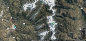
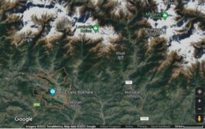
My main concern moving forward is how few large population centres are near to glacial lakes in the region. For my 4th year dissertation I did a similar project in the Peruvian Andes and spent a few months trying to wipe out the city of Huaraz. I didn’t realise quite how spoilt I was. Currently it seems like the best option would be the city of Pokhara in Nepal. It’s a large population centre, with about 458,000 residents so that answers my social relevance part pretty immediately (‘half a million people might die’ is pretty good as justifications go even if it’s pretty morbid). It is nice and near to glaciers and glacial lakes and is at the bottom of a large valley system. In fact the aerial imagery is pretty similar to that of Huaraz.


Images: (left) satellite imagery of Huaraz, Peru. (right) satellite imagery of Pokahara, Nepal.
The next biggest concern I have is in terms of accessing a high quality DEM. This is an issue I faced last year as well, and while it is possible to run a flood model on a 30 m resolution model, it isn’t ideal and will give less reliable results than we could otherwise expect. But at the same time the scale of the model might benefit from a coarser resolution, too high resolution could well cause my computer to take off when it tries to run it so we’ll cross that bridge when we come to it.
Tentative methods
I’ll model flooding in HEC-RAS. it’s an open source flood model developed by the US army corp of engineers and has quite a wide variety of uses. I gained a lot of experience with it last year so already know a lot of what i need to do this time round.
Glacier retreat is something i can look at in Google Earth Engine. It’s not something i’m particularly familiar with but it seems like it has a lot of potential and appears to be used quite regularly for this kind of work. Rhona has very kindly sent me her 4th year dissertation and she used this to mark glacier retreat in the antarctic so i might steal some of her methods from last year.
But I’m excited to get started and see if this all works together, as soon as the lit review is out of the way.


Recent comments