Mikaël Attal
Professor of Geomorphology @ the School of GeoSciences

| Room: | 1.05b |
| Address: | Institute of Geography, Drummond Street, Edinburgh EH8 9XP |
| Phone: | +44 (0) 131 650 8533 |
| FAX: | +44 (0) 131 650 2524 |
| Email: | mikael.attal@ed.ac.uk |
______________________________________________________________________
Publications: click here.
Why does teaching matter? See my blog post here.
Geomorphology, rivers and humans: listen to my first podcast here.
My travel blog: Travels through geomorphology.
______________________________________________________________________
Research interest: Within the Global Change research group, I am part of the Land Surface Dynamics research group. I combine the analysis of real landscapes (collection of field data, topographic analysis) with numerical modelling and experimental studies to constrain the relationships between tectonics, erosion and the development of topography. My current research focuses on erosion processes in mountainous landscapes: I study the processes that drive sediment production, transport, erosion and deposition, and the hazards associated with these processes. My work can help extracting tectonic information from topography, with implication for assessing seismic and landslide hazard. Understanding the release and transfer of sediment can also help retrieving past tectonic and climatic signals in the geological archive (stratigraphy), as well as mitigating risks in sedimentary basins. Current research projects include: erosion processes, rates and hazards in China (Sichuan, Danxiashan, Loess Plateau); tectonic geomorphology and seismic risk along the Palu-Koro Fault (Indonesia); sediment transport and pollution associated with legacy mines (Scotland).
If you want to know more about me: Click here to see my full CV. Find me on LinkedIn.
The School of GeoSciences website: http://www.geos.ed.ac.uk/.

______________________________________________________________________
Edinburgh PhD students:
| – ZIDONG YAO is assessing the effects of sediment transport on the mobility and dispersal of pollutants in rivers and catchments. |
| – DONNY WAHYUDI is using geomorphic indicators to infer relative motion along the Palu-Koro Fault, Indonesia. |
| – DAPHNE MYHRVOLD is investigating human-environment interactions at Heit el-Ghurab (The Lost City of the Pyramids), Giza, Egypt. |
| – RUTGER VERVOORDELDONK is investigating the influence of geology on the geometry of river networks. |
Past PhD students – graduated:
| – Dr MASOOD REHMAN was investigating the environmental, social and political drivers of drought vulnerability in Balochistan, Pakistan. |
| – Dr ANYA TOWERS was assessing sediment mobility, transport and controls on sediment grain size in Scottish rivers. |
| – Dr QIUYANG CHEN was characterizing the morphology, function and dynamics of large rivers using remote sensing. |
| – Dr ANTHONY HOSKINS was investigating drainage reorganization in South Baja California, Mexico, to assess whether we can use landscapes and cosmogenic nuclides to reconstruct the history of tectonically complex areas. |
| – Dr SARASWATI THAPA was modelling the impact of sediment transport on flood risk in the Kathmandu basin. |
| – Dr PRAKASH POKHREL was studying the geomorphic and sedimentological evidence for the Neogene evolution of the Kathmandu Basin. |
| – Dr EMMA GRAF has been constraining sediment transfer from source to sink in the Himalaya, with a focus on post-Gorkha 2015’s sediment pulses. |
| – Dr JUSTINE DOMINGO has investigated sediment and pollutant dispersion in mining-affected areas in the Philippines. |
| – Dr LAURA QUICK has been constraining sediment dynamics at the front of the Himalaya by comparing modern and ancient (Neogene) systems. |
| – Dr CHRYSTIANN LAVARINI looked at bias in the detrital record due to pebble abrasion. |
| – Dr REBEKAH HARRIES unravelled climate and tectonic changes in the sediment record using the Jáchal region, South Central Andes as a natural laboratory. |
| – Dr LIZZIE DINGLE constrained river dynamics in the Himalayan foreland basin. |
| – Dr FIONA CLUBB modelled the competition between climatic and geologic control on the development of landscapes. |
| – Dr EDWIN BAYNES has quantified bedrock erosion during extreme flood events in Iceland. |
| See Ed’s Icelandic videos: Iceland PhD fieldwork June 2012 —– Iceland PhD fieldwork part 2, August 2012 —– A field work saga, Iceland 2013 —– Iceland: a research story. |
| Listen to Ed talking about his project on Radio New Zealand National (the interview covers many aspects of his project, it’s very nice – don’t get distracted by the opening sentence!): Podcast. |
| – Dr MARTIN HURST used hillslopes as recording devices to investigate how landscapes adjust to tectonic changes. |
______________________________________________________________________
APPLY FOR A PhD PROJECT IN GEOSCIENCES.
To apply for a PhD or to browse the PhD projects available through the new E5 Doctoral Training Partnership funded by the NERC: https://e5-dtp.ed.ac.uk/supervisor-led-projects. Please check the deadlines, eligibility and funding rules before contacting a potential supervisor.
______________________________________________________________________
TOPOGRAPHIC ANALYSIS
– LSDTopoTools Package
The Land Surface Dynamics group has released a package to do topographic analyses, including the “chi-analysis” (see Perron and Royden, 2013) which has the advantage of not being sensitive to the noise inherent to topographic data (i.e., slope-area data tend to be very noisy because of steps in river profiles). The paper presenting the tool and its application is available: click here. Simon Mudd and his team of hackers have designed a book in addition to the package. Both can be found on Github: the book and the package. Feel free to try it and give some feedback!
– “Geology and Landscapes”-related material
| – 12.5-m resolution DEM data now available (ALOS PALSAR DEM). The site with the data is there: https://vertex.daac.asf.alaska.edu/. |
| – 30-m resolution DEM from ALOS available now too. The data seems better quality than SRTM, made from more recent images (SRTM is from 2000 and this one is a mosaic of many images 2006-2011). The site with the registration form and data is there: https://www.eorc.jaxa.jp/ALOS/en/aw3d30/index.htm. |
| – To download SRTM data: http://earthexplorer.usgs.gov/. |
| – To download ASTER data: https://reverb.echo.nasa.gov/. |
| – Geological maps and cross-sections handout, presenting basic information on how to read a map and how to build a geological cross-section: Maps and cross-sections handout. |
| – Downloading 10-m resolution DEM data of the UK using the Digimap service. This handout presents the procedure to download the data and import it in ArcMap (note that access to Digimap is restricted): Digimap handout. |
| – Link to the geological version of Google map by the BGS (click on “map” then “simple view”): http://www.bgs.ac.uk/opengeoscience/. |
| – Cycling around the geology and geomorphology of Midlothian. Discover the geology and landscapes of Midlothian with a 52-km cycle loop starting from Edinburgh: Midlothian Geocycle handout. |
ArcMap / QGIS handouts for topographic analysis
| ArcMap | QGIS | |
| – Procedure to load data in Arc / QGIS, georeference images (e.g., geological maps) and do a basic topographic analysis (1st year practical): | Georeferencing – ArcScene handout | IGR_PracticalQGIS |
| – Topographic analysis handout, including how to perform basic topographic analysis, extract river profiles and visualise topography and geology in Arc / QGIS: | Topographic Analysis | Topographic Analysis Betics_QGIS |
| – Preparing a base map for field work: | Base map handout | See below |
Excellent QGIS training resources: webinars by Kurt Menke and Hans van der Kwast that “demonstrate the 7 chapters
of the book QGIS for Hydrological Applications – Recipes for Catchment Hydrology and Water Management”. Click here. The last one is about map design.
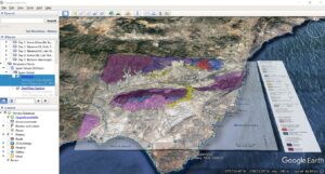
For those teaching in the Betics: I have digitised Weijemars’ original 1991 regional map, coloured the basement and the Messinian reef, and georeferenced in Google Earth. It is a great tool to navigate this area’s spectacular tectonic geomorphology! Download the kml file.
______________________________________________________________________
Determining sediment grain size distribution (GSD):
You will find here a handout and a series of useful files explaining how to determine a sediment GSD using photographic methods (and the software ERDAS IMAGINE) and volumetric methods (digging and sieving): Handout and Useful files.
______________________________________________________________________
Video of the Inchnadamph field trip (NW Scotland):
This is a lovely video made by Simon Jung about the two-week field trip that third year students in Earth Science attend. A nice taster of Scotland and its amazing geology and landscapes (to me, this is one of the most beautiful places in the world): http://www.youtube.com/watch?v=Xe12VVXh93A&feature=youtu.be.
______________________________________________________________________
SteepestDescent talk, 3rd May 2014:
SteepestDescent is “a day of focused interactions and networking between people interested in surface dynamics” happening on the Saturday after the EGU conference, in the spirit of the Gilbert Club following the AGU conference. If you are interested in my talk: SteepestDescent.ppt.
______________________________________________________________________
Really cool: the Geological Society’s 100 great geosites: click HERE for the interactive map and exciting pictures.
I am a bit disappointed the Helmsdale Boulder beds are not featured…
______________________________________________________________________
INFLUENCE OF WOLVES ON RIVERS, beautifully illustrated and narrated: click HERE.
______________________________________________________________________
GRAVEL BED RIVERS CONFERENCE 8, September 2015:
The Gravel Bed Rivers conference 8 just took place in Kyoto and Takayama, Japan, on the theme “Gravel bed rivers and disasters”. The conference takes place every five years and leads to the production of a book presenting the work shown in the talks. You can find the list of talks (and therefore, incidentally, book chapters) there: GBR8 Programme. The talks have been recorded and can be seen there: GBR8 talks (my talk is in session 7, starting at ~30 minutes). The book is now available here. In the meantime, if you are interested in my talk on “Linkage between sediment transport and supply in mountain rivers”, here is the ppt: Part 1 and Part 2.
______________________________________________________________________
LANDSCAPES LIVE, November 2020:
Alex Whittaker and I were asked to present a tribute to Patience Cowie who sadly passed away at the beginning of the year. This is our Faulting and Landscapes presentation, where we tried to cover some of the many highlights of Patience’s work: https://www.youtube.com/watch?v=drO2wj1pMp4&feature=youtu.be.
______________________________________________________________________
12th INTERNATIONAL CONFERENCE ON SCOUR AND EROSION, November 2025:
The 12th International Conference on Scour and Erosion took place in Chongqing, China, in November 2025, on the theme of “Advancement of Scour and Erosion for sustainable development”. Extended abstracts are available at the online library of the International Society for Soil Mechanics and Geotechnical Engineering: ISSMGE Online Library. If you are interested in my talk on “Catastrophic Remobilization of Sediment During Extreme Rainfall Events”, here is the PDF version: ICSE12_Attal.
Recent comments