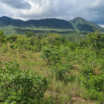
 Vegetation types map of Zimbabwe – Collaboration with Zimbabwe Forestry Commission
In Zimbabwe, there is a data gap with little current information on the distribution of vegetation types and their biodiversity and carbon stocks. We estimate tree diversity and carbon stocks based on plot data (2012-2023, n=510) and use this to calibrate a new map of the main vegetation types in Zimbabwe based on a fusion of satellite data.
I am also passionate about connecting art and science
In 2025, I worked with other PhD students to encourage our colleagues to make art related to environmental science to exhibit in our building. Read the blog below hear about our experience and view some of the artwork!
“We started rogue decorating”: How a stairwell art exhibit came to life at Crew