
Welcome to the start of a new term and a new academic year! We very much hope that 2021/22 will be settled and productive with studies and research returning stronger than ever before. We have some exciting developments with Digimap for the coming session which we hope you will enjoy reading about and will find of use in your work over the coming year. As ever, we welcome feedback and suggestions; please don’t hesitate to contact us, either by email or on our social media channels (links below).
New Digimap Help Pages
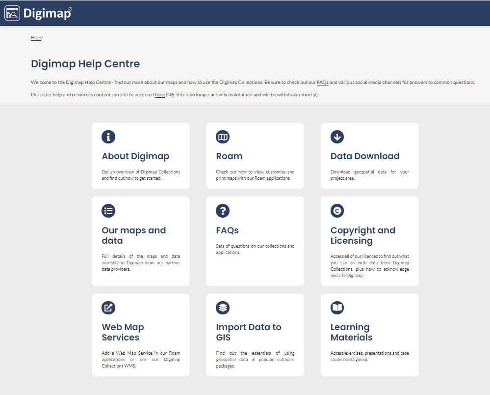 We are delighted to report that this month we have launched a new Help system for Digimap. All our help pages have been reviewed, updated and re-presented. They are now easier to navigate and easier to read. We hope it will be much easier to find the help you need. We will continue to review, amend and update the information.
If you have bookmarks to the old help system, they will still work for a short period, but will not necessarily offer the most up to date information.
agCensus Digimap

Digimap’s newest data collection is the agCensus Digimap service offering agricultural census data for England, Scotland and Wales. These are grid-square estimates of a wide variety of farm statistics, ranging from farm workers, to strawberries, beef cattle to beetroot, derived from agricultural census surveys conducted by each national administration.
Your institution can subscribe to agCensus Digimap and access the data through our easy-to-use Data Download application.
Environment Digimap – new data
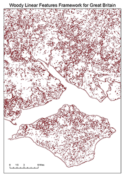
With thanks to the UK Centre for Ecology & Hydrology, Environment Digimap now offers three additional datasets. These are: Integrated Hydrological Digital Terrain Model, UKCEH 1:50,000 Digital River Network and Woody Linear Features Framework. Check out the new datasets in Environment Download.
Image © UKCEH
Aerial Digimap – 2020 data added
Despite so many challenges affecting the rest of our lives, 2020 was a fantastic year for flying aerial photography – some great, clear weather and almost all air traffic grounded because of the pandemic.
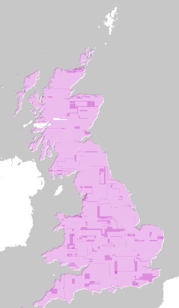
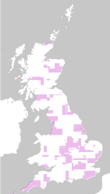
As a result, Aerial Digimap has had a bumper data update from Getmapping plc with 107,770 km2 of land covered by new images. This means 323,310 files or around 44% of data tiles have been updated! The first image shows the coverage of the new 2020 data. The second image shows the total coverage of aerial imagery flown within the last 3 years.
|
|
|
Over the coming weeks the composite coverage available through Aerial Roam will be updated with the new data. In the meantime, 2020 data can already be downloaded from Aerial Download.
Improvement Service Data
Your subscription to the Ordnance Survey Collection in Digimap now automatically includes Scottish local authority data from the Improvement Service. This collection covers more than 40 datasets created and curated by Scotland’s 32 local authorities. The data are wide ranging, from air quality management, alcohol prohibition areas and car parking, to care homes for the elderly, GP practices and school catchments. The data can be found in the OS Collection Data Download, under Improvement Service – Scotland.
See full list of Improvement Service datasets.
Forthcoming Webinars
We are pleased to announce the next webinar series for Digimap. Anyone is welcome to join these but placees are limited so please register online in good time. Recordings of previous webinars can be found on our YouTube channel.
- Digimap Collections: an introduction
These webinars are for those who are new to Digimap Collections. We will introduce the key features of Roam, our Digimap mapper, and consider when you would use Data Download. You will have the chance to ask questions.
- Historic Digimap
- 10th November 2021, 12:30-1:15pm REGISTER
Guest speaker: Rick Crowhurst, Senior Public Sector Manager, Landmark Solutions
- 10th November 2021, 12:30-1:15pm REGISTER
Find out what historical maps are available in Historic Digimap, which are provided by Landmark Solutions. Rick Crowhurst will tell us about the County, Town Plan and National Grid maps that you can access and their potential uses. The Digimap team will demonstrate the use of Historic Roam, where you can view, compare and print the maps. You will have the chance to ask questions.
- Geology Digimap
- 17th November 2021, 12:30-1:15pm REGISTER
- Guest speaker: Russell Lawley, Product Development Team Leader, British Geological Survey
Find out about the range of British Geological Survey data products available in Geology Digimap from Russell Lawley of BGS Product Development. The Digimap team will demonstrate the use of Geology Roam, where you can view, compare and print the maps. You will have the chance to ask questions.
Here to help
The Digimap support team offers assistance to all Digimap users with the use of the service. If you have any questions about any aspect of Digimap, it’s use, the data it offers, subscriptions or its future, please get in touch.