Free trial of Northern Ireland data available NOW !

Any institution subscribing to Digimap’s Ordnance Survey Collection can now take a free trial of the Ordnance Survey Northern Ireland (OSNI) data. The free trial lasts until 31st July 2019.

The OSNI data can be accessed within Digimap’s Ordnance Survey Collection. Log in to Digimap and choose Data Download from the OS Collection. You will see the OSNI heading in the list of available data on the left hand side:

Download OSNI data
OSNI data can be found in Data Download

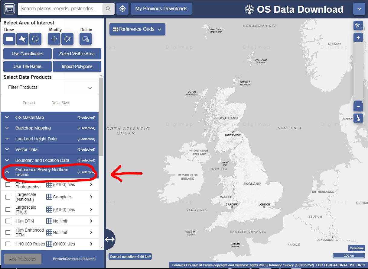
A range of raster and vector data is available at scales ranging from 1:2500 to 1:1 million. Aerial photographs are also included. All OSNI data is currently available for download and will be added to Roam in due course.

To sign up to the free trial, please contact your Digimap site representative or EDINA to express your interest. The trial is free but requires a subscription process to be completed by an authorised person.

If you have any questions about the OSNI data, we’re happy to help. Please contact us on digimap@ed.ac.uk or 0131 650 3302.

Digimap Updates Webinar: 16th May 2019

Over the next few weeks we will be running a programme of webinars covering updates to Digimap, Global and Society Collections and the Ordnance Survey Northern Ireland data, including how you can access these new services. A separate webinar to discuss and answer any questions on data licences will also be scheduled.

The first webinar will be on Thursday 16th May (13:00-13:45) where we will demonstrate all the recent and forthcoming changes. There will be ample opportunity to ask questions but places are limited so please register online if you wish to attend.

Don’t worry if you can’t make this webinar, it will be repeated on 23rd May and 30th May, details and registration links can be found on our Events page.

2018 data for CEH Land Cover Plus: Crops

We are pleased to say that the 2018 update to the CEH Land Cover® Plus: Crops dataset is now available through Environment Digimap.

CEH Land Cover® Plus: Crops has been produced by the Centre for Ecology & Hydrology in partnership with Remote Sensing Applications Consultants and provides annually updated arable crop information for the whole of Great Britain. You can read more about it in our previous blog post.

You can find the 2018 data under the Basemaps in Environment Roam and under the Crop Data heading in Environment Download.

OpenStreetMap… want to know more?

All Digimap users currently have free access to Global Digimap until 31st July 2019 as a trial.  We hope you like this new service.  If you would like to learn more about the OpenStreetMap data, it’s origins and history, from someone who is more than qualified to tell the story, Steve Chilton is giving a talk at #geomob in London on 19th June 2019 about this very subject.

For more details, visit the #geomob website: https://thegeomob.com/post/june-19th-2019-geomoblon-details