
On 1st August 2018 EDINA launched a new Digimap Collection, one that aims to provide data for the whole world, not just Great Britain.
Global Digimap is now available as a beta service as we look to build a suite of datasets, themes and formats that best meets the needs of our users. We will continue to develop the Global Digimap service over the coming months, shaped by the feedback that you give.
During this development phase, and in return for engagement with the development process, the service will be free of charge for institutions that subscribe to another Digimap Collection. We would like to know what you like and don’t like about it, what features and what new data you would like to see added. We can’t promise to include everything but the more we hear from you the better able we are to prioritise different requirements and create the best possible service.
“We are developing this service in partnership with the community; it will be subject to continuous improvements. Please keep checking back to see how it develops; please keep the feedback coming; please be understanding if the service is different today from yesterday!”
Below are details about the data and service available now, and what we plan to include in the short term. It is never too early to let us know what else you would like to see, we are very keen to hear from you; our contact details are at the bottom of this post.
Overview
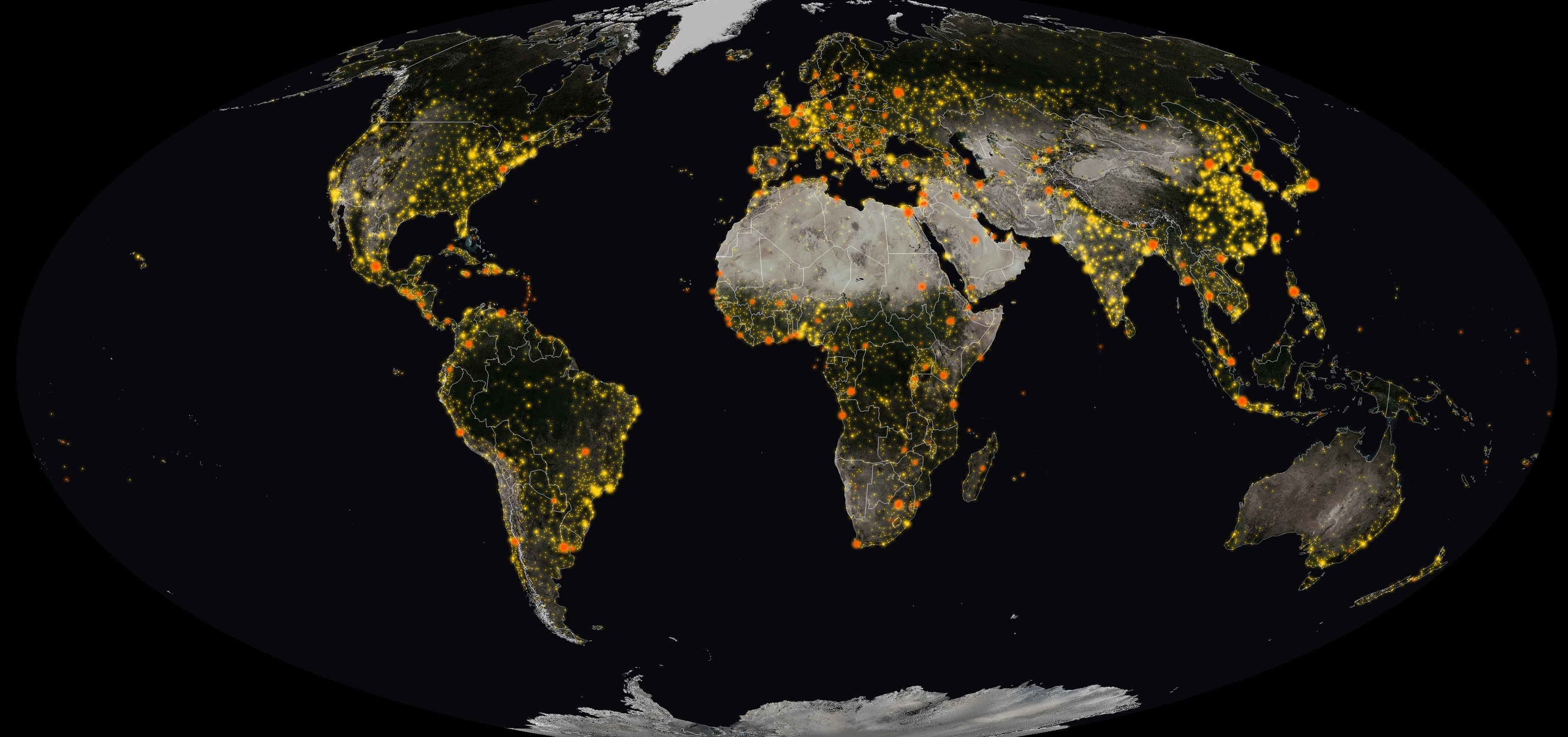
The service is currently built around two key datasets, OpenStreetMap and Natural Earth, but we will be looking to add more on your recommendation. We will also be using the two familiar Digimap interfaces, Roam and Data Download to provide access to the data.
OpenStreetMap
This is a global dataset created by contributors either volunteering their time or working on projects that are adding information to the dataset. Feature types and attribute information is carried mostly in a single data column as tags in the data’s raw format. We have created our own instance of the data which we update on a daily basis. From our own database we will be creating a set of more usable data tables each weekend, to provide users with data to download in more usable themes.
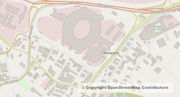
There is an amazing amount of information in OpenStreetMap but it is quite inconsistent; there are areas where the quantity and quality of mapping is incredible, most of Germany is covered in great detail and Edinburgh too. There are of course other areas where not much detail has been captured at all, however the great thing about OpenStreetMap is that you can contribute and capture the data yourself. The data should never be considered to be definitive but in many cases it is the best data, sometimes the only data, available for a location.
We have categorised OpenStreetMap data so that we can deliver it in a set of themes for download: Buildings, Landuse, Natural Places, Place of Worship, Points of Interest, Railways, Roads, Traffic, Transport, Water, Waterways. We are also hoping to add Addresses and Administrative Boundaries as layers soon too.
We will provide the data in Geopackage and File Geodatabase formats for ease of use in QGIS and ArcGIS but hope to add DWG format data too. The DWG format will mean that building outlines from around the globe will be available for CAD users.
We are also creating cartographies for the data so that you can view, annotate and print it using the Global Roam interface.
Natural Earth
Natural Earth data is a curated set of small scale, (1:10m, 1:50m and 1:110m) mapping datasets that are great for using in overview maps or to show global analysis. This is an Open dataset so can be used for any purpose, not just academic. We will be using the Natural Earth data in Global Roam and Global Download as the interface maps at the most zoomed out levels.
As we have the data we will be providing through the download interface which will be a more convenient way to get multiple layers of data than the Natural Earth website. When we introduce clipping of vector data downloads in the future this will add a very useful dimension. This will enable you to select your own areas of data rather than having to take global coverage.
What can I see now?
Global Download
The download interface will allow you to take OpenStreetMap data in Geopackage and File Geodatabase formats. There is the ability to select themes limiting the number of features you get in your data. Not all the OpenStreetMap data falls into one of the themes but we are working to incorporate as much as possible. As such the themes are subject to change.
Going forward we will be adding the Natural Earth Data and others requested by users where possible. We will also be looking for feedback on new themes to add to the OpenStreetMap data and extra feature types to add to existing themes.
Global Roam (Coming Soon!)
The familiar Roam interface with the usual annotation tools and a global search will be added to the collection very shortly. The most zoomed out maps will use Natural Earth Data which will change to OpenStreetMap as you zoom in. We will be creating grey-scale and colour themes, but we want to grow this range quickly. Our print interface will be integrated, allowing high quality printed maps up to A0 too though this will come later. We also plan to allow customisation of the maps using the groups and themes we develop, later in the year.
What we’d like you to tell us:
Global Digimap is going to be a collaborative project between the academic community and EDINA. We want to produce a service that will meet the needs of the majority of the community, making global datasets accessible to as broad an audience as possible for teaching and research. This is ambitious and we accept that we won’t be able to meet everyone’s needs all the time, however if you never let us know what they are we won’t have a chance to try.
Are there any other datasets you like to see us include in this collection?
If you know of global datasets that you’d like to see in the collection please let us know. We aren’t always able to include datasets but we will try to include any that are possible. Please note that many Open datasets have non-redistribution clauses that prevent us from simply delivering them through Digimap. However it is always worth bringing them to our attention as we may be able to secure an exemption.
Are there any additional Themes you want us to make available for download?
OpenStreetMap data is huge and very complex, so if there is any way we can make it more accessible then let us know. We are aware that many features have been captured in different ways in different countries, regions or sometimes simply by different people. We are also aware that it is difficult to get large areas of the data with all the features you need or in the format you want If there is a particular subset of features that you need then let us know. If there is wider demand for this then we will aim to create them for the service.
What basemap styles would you like to see in Roam?
We would like to see the OpenStreetMap data utilised to its full potential and so we would like to create different basemaps to highlight different feature types. If you’d like a basemap that highlights natural features like forests, marshes and protected areas; one for road networks; residential, commercial and industrial zones; or perhaps a heritage and antiquities basemap then we’d like to hear from you. If you have already done some work with OpenStreetMap to create a particular style for your field of study then we’d be very interested if you would like to share your work to make the style more widely available through Digimap.
What formats suit the research you want to carry out?
For OpenStreetMap we are aiming to cover GIS and CAD with the Geopackage, File Geodatabase and DWG formats. However if there are other formats you’d really like to see then please let us know. We appreciate that many users may like to see Shapefile formatted data and if demand is strong enough we may provide some limited feature sets in this format. Do note that the file size and geometry type limitations of Shapefiles don’t make them ideal for OpenStreetMap data.
Natural Earth vector data comes supplied as Shapefile so we will pass this format on to users, we will look to convert the data in to other appropriate vector formats like Geopackage and File Geodatabase. We will also be looking to clip these datasets to the area defined by the user in the interface, to keep download sizes small and to make the data fit the users requirements more closely.
Natural Earth Raster Data comes supplied as GeoTiffs and again we will make these available for download. If there are any other raster formats that you need then please get in touch. Again we will be looking to clip these datasets to the user defined area in the interface.
Get in touch
This is what we have planned but there is scope for so much more, so please get in touch with your ideas so we can start to build something amazing:
- Email: edina@ed.ac.uk [Subject: Global Digimap]
- Phone: 0131 650 3302