Monitoring Mangrove Forest Cover in Nigeria
Mangrove forests are coastal vegetation found in the zone occasionally washed up by ocean tides. Mangrove trees have the ability to tolerate saltwater, low oxygen and wave pressure because of their structure. They provide ecosystem services including fisheries, flood and storm protection, water filtration and aesthetic values for local communities. Mangrove forests have the potential to store large amounts of carbon, particularly in their muddy sediments. These services provided by mangrove forests make them a focal point for climate change mitigation. Because of this, the conservation and sustainability of mangrove forests are globally important.

Mangrove Loss
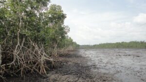
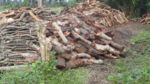
Coastal environments often also have high population density and this can result in pollution and development. One example of this is the Nigerian mangrove forests, where oil pollution, development projects and unregulated mangrove wood harvesting have affected the coastal region. Nigeria has the largest mangrove forest in Africa and fifth largest in the world with the Niger Delta region covering about 801, 774 hectares in 2017.
Our study found that mangrove forests in the Niger Delta have lost about 109, 774 hectares (12 %) between 2007 and 2017. Considering the carbon potential of mangrove forests, the continuous loss of mangrove forests can lead to carbon dioxide release.

New Neighbours
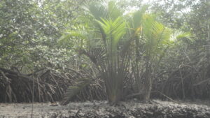
Nipa Palm (Nypa fruticans) is an exotic mangrove palm, which is not native to Nigeria. This mangrove palm was introduced in coastal Nigeria in the 1900s for beach erosion control but due to poor management, Nipa Palm is now colonizing deforested mangrove land.
Our study is the first to report a Nipa Palm area in the Niger Delta, estimated to be 11, 444 hectares in 2017 using earth observation satellite. Oil pollution, clearance for developmental projects and unsustainable mangrove wood harvesting has disturbed mangrove forests and created an open ground for the growth of Nipa palm. The colonization of this invasive species in the Niger Delta is now threatening the integrity of mangrove forest dominance in the region.

Solutions
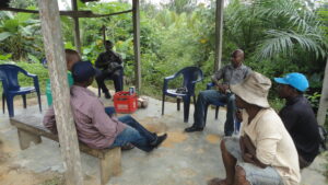
Data available from earth observation satellites can help improve the monitoring of regional mangrove loss. This requires a combination of data collected through fieldwork and analysis of geographical spatial data. Field data collection can only be consolidated with the local community’s involvement. This requires education of local communities regarding the sustainable use of mangrove resources so that they are involved in mangrove management. Our study has shown that earth observation satellites can be utilized in the sustainable use of environmental resources. This includes not only monitoring threats to mangrove forest loss but also assessing the conservation potential.

References: Nwobi, C., Williams, M. and Mitchard, E.T., 2020. Rapid Mangrove Forest Loss and Nipa Palm (Nypa fruticans) Expansion in the Niger Delta, 2007–2017. Remote Sensing, 12(14), p.2344.


