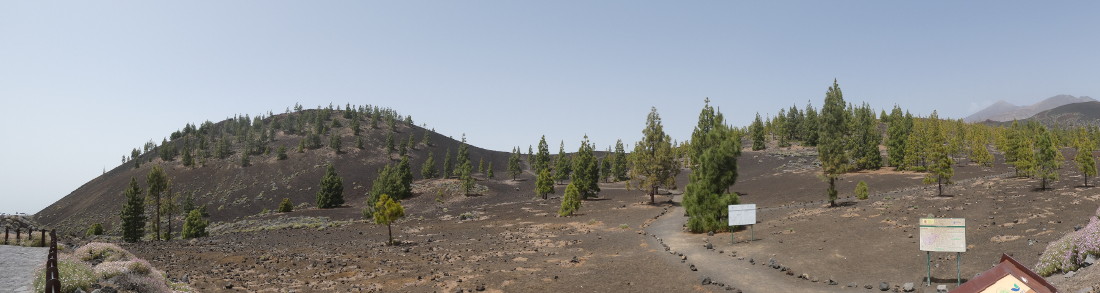
My classic lump from this year’s holiday in Tenerife was Montaña Sámara. At 1937m above sea level it sounds quite impressive, until you note that the nearby car park is at 1875m, leaving only about 62m of ascent and half a kilometre of walking (one way). Like Montaña Chayofita, this hill is a cinder cone: the result of a single moderate-sized volcanic eruption. Unlike Montaña Chayofita it is not surrounded by a holiday resort but is near the centre of the island, in the Parque Nacional del Teide. The hill appears to be made entirely of dark-coloured volcanic ash, sparsely vegetated with a sprinkling of Canarian Pine trees.
The car park is on the TF-38 road that leads up from the town of Chio into the national park. It is immediately apparent on parking that the walk to the summit is not going to be too much of a physical or navigational challenge.
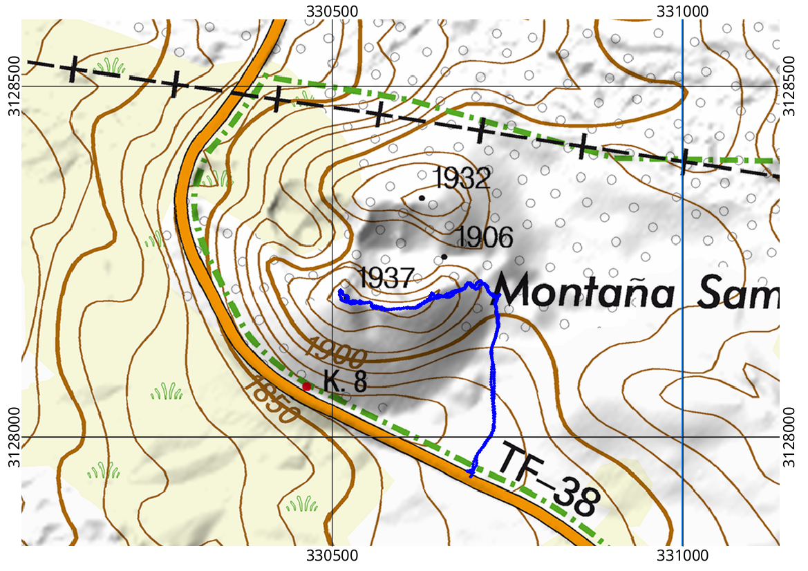
The first 250m are gentle ascent on a good path. Various paths then converge, including one that goes into the crater, should you wish to inspect it, and one leading away into the distance. We eschewed these, picking the obvious ascent up the near side of the crater. After 30m of stiff ascent on nasty gravelly cinders we reached a short, airy ridge leading to the summit. A keen visitor with more time on their hands could easily visit the North side of the crater; I was pleased to see when I made the map above that it is slightly lower than the South summit.
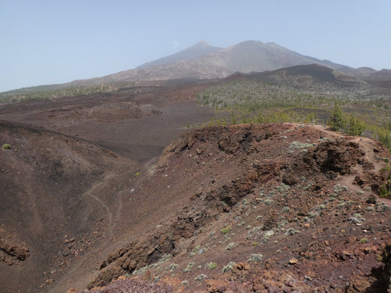
The view inland shows the crater of Montaña Sámara in the foreground, with the summit of Pico del Teide in the background; this is not only the tallest mountain on the island, but is also the highest point in the whole of Spain. The view seawards would probably be splendid on a clear day, but when we visited it was very hazy; we could not see down to the coast at all.
Descent, as you can see from my GPS trail on the map is the reverse of the ascent. The cinders are very slippery on the way down and showed an annoying tendency to get inside my walking sandals. If you are going to attempt the walk yourself, I would recommend closed shoes!
Postscript:
A few days after making this post, I used NASA’s splendid WorldView tool to have a look at the aerosol content of the atmosphere on the day we did the Montaña Sámara walk (Wednesday 11 July 2018). 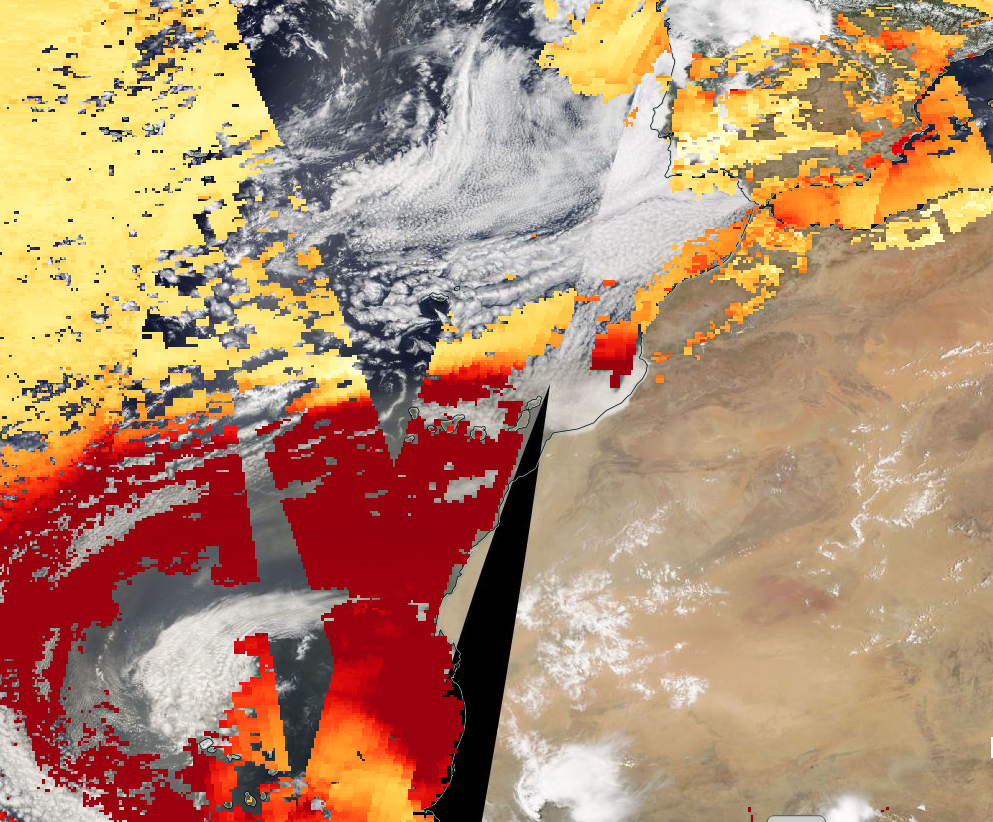
The Canary islands are right in the centre of the image. The colour scale used for Aerosol optical depth (where it is available) are such that yellow means low amounts of aerosol, orange and red mean greater amounts and brown means lots of aerosol. Aerosol means any tiny particles of stuff in the air which are not just water or ice. The commonest sorts include sea salt, mineral dust, black carbon (in smoke from fires) and sulphate (from anything that emits Sulphur dioxide, including volcanoes). In this case, the large area of high aerosol in the bottom left of the image is mineral dust blowing off the Sahara desert into the Atlantic ocean. The Canaries on the day we did the walk were well inside the high-aerosol region so it is not surprising that the visibility was poor.


One Reply to “Another day, another volcano”